Mobile geospatial tool for Indonesian village governance and planning
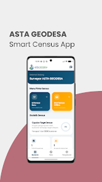
ASTAGEODESA, by PT. Real Media Lab, is an Android application for village administrations to map territories and manage administrative records. The app combines mobile geospatial data collection, village boundary mapping, and offline-capable census tools to capture spatial, demographic, and economic data in the field. It includes user management, reporting, and a developer-supplied manual, making it suitable for village officials and local planners conducting digitalization and spatial planning tasks.
What ASTAGEODESA does for village spatial records
ASTAGEODESA functions as a mobile platform for village spatial planning, designed to collect geospatial data, map village boundaries, and record village assets. The app supports integration with Tata Ruang systems and produces spatial visualizations and reports, so village teams can convert field survey points into documented maps and administrative records for planning activities.
How the app structures field-to-office workflows
The app supports mobile census tools and offline data entry, enabling surveyors to gather demographic and economic indicators away from reliable internet, then synchronize later. User management lets village-level administrators assign roles during field campaigns, and reporting features create visual summaries of spatial assets that planners can use when allocating resources or preparing development proposals.
Onboarding, compatibility, and operational fit for local teams
Distributed through the Google Play Store for Android, the app includes a developer-supplied Manual Book to guide village officials through data input and mapping procedures. The developer’s focus on Indonesian administrative structure means the interface aligns with local workflows, which helps local government planners and community leaders use the tool without redesigning existing processes.
Practical choice for village planners needing mobile geospatial data
ASTAGEODESA is a purpose-built option for Indonesian village officials and local planners who require mobile boundary mapping, offline census collection, and alignment with Tata Ruang workflows. Its Android orientation and provided manual reduce deployment friction for field teams. Those needing cross-platform desktop editing or advanced GIS analysis should pair the app with dedicated desktop GIS software.